One of the most scenic roads in America, Montana’s Going-to-the-Sun Road stretches from one end of Glacier National Park to the other, covering more than 50 miles as it winds past lakes, glaciers, forests and mountains.
Visitors to Glacier NP owe it to themselves to see most or all of the road by car or shuttle to soak in the awe-inspiring sights.
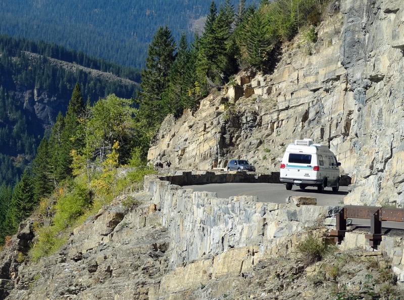
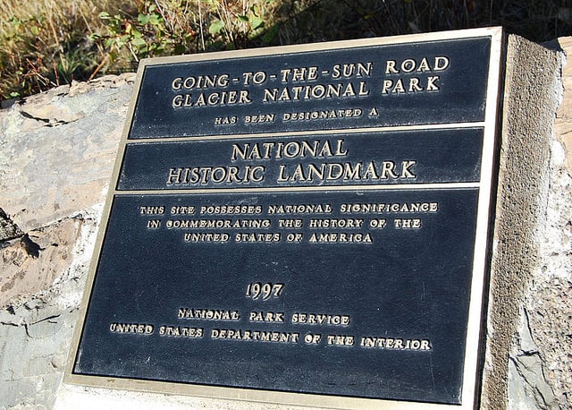
Officially open to the public in July of 1933, Going-to-the-Sun Road was an engineering landmark, and nowhere is that more obvious than at “The Loop,” where the road rises along the edge of the mountain and makes sharp hairpin turns.
It was the first road to be designated both a National Historic Landmark and a National Civil Engineering Landmark.
Though Going-to-the-Sun Road isn’t that long in terms of mileage, don’t be fooled into thinking you can drive the whole thing in an hour. There are lots of scenic overlooks and points of interest along the way, so don’t rush through it.
How long does Going to the Sun Road take to drive in its entirety? To truly experience Going-to-the-Sun Road, set aside at least one full day.
That way, you’ll have time to stop at every noteworthy spot and take some hiking detours. If you’re short on time, give yourself a bare minimum of three hours.
Portions of Going-to-the-Sun Road can accumulate up to 80 feet of snow (!!) in the winter, which is why it takes crews more than two months to plow the road in late spring.
The road doesn’t fully open each year until June (sometimes even July), and by October portions are closed again due to early snows.
Check the National Park Service’s Going-to-the-Sun Road status page for real-time info on which portions of the road are currently open to vehicles.
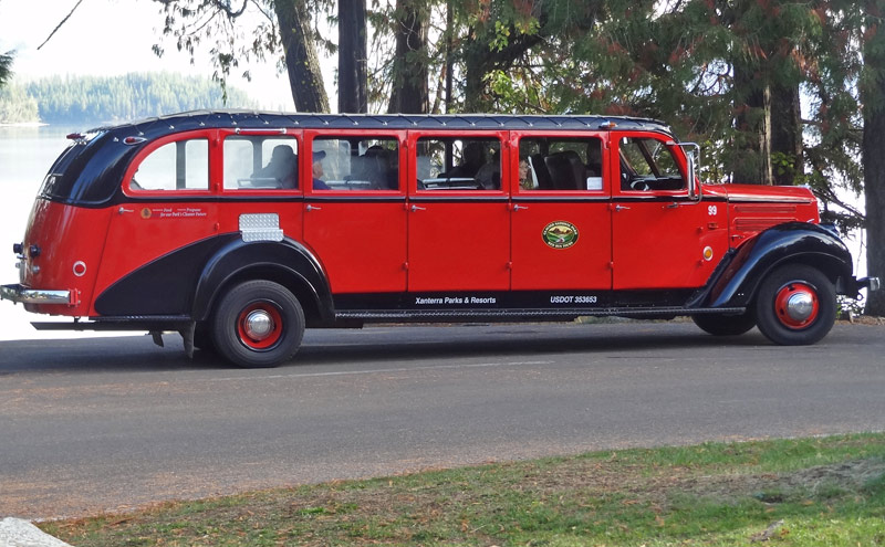
If you don’t feel like driving, you can always catch a Red Bus Tour and ride the shuttle throughout the park.
And remember, large portions of the road have no cell phone access, so be prepared to put away your electronic device and enjoy the scenery!
UPDATE: In recent years, Glacier National Park has instituted a vehicle reservation system. From July 1 to Labor Day, you must have a reservation to drive the western end of this road between 6 am and 3 pm.
Going to the Sun Road: A Mile By Mile Guide
This guide assumes you’re starting in the west and driving east, which is a common route for folks who fly into Kalispell or drive to Glacier NP from the south or west.
How long is Going-to-the-Sun Road? The full road is between 50-53 miles, depending on your source (even various NPS publications disagree on the exact length.)
We’re calling it 52 miles based on the official park brochure map.
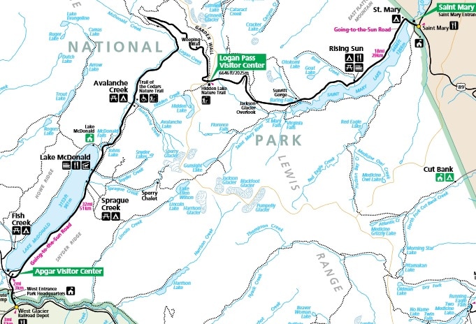
What’s the elevation of Going-to-the-Sun Road? The elevation varies quite a bit. The West Glacier entrance and Lake McDonald both sit at around 3200 feet above sea level.
The Loop is 4400 feet elevation, and the road reaches a high point of 6,646 feet at Logan Pass. That’s more than a mile high!
From there, the elevation gradually declines. The Jackson Glacier overlook is at 5350 feet, and the St. Mary Visitor Center on the eastern end of the road has an elevation of 4480 feet.
RECOMMENDED MONTANA TOURS:
Mile 0: West Glacier
Going-to-the-Sun Road begins at Route 2 right by the West Glacier Amtrak station. Talk about convenient!
You can literally take a train from downtown Chicago in the east or from Seattle in the west and get off right at the start of this road. Car rentals are available next to the train station.
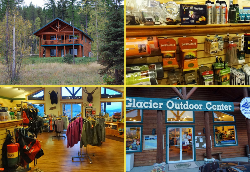
Just off the road is Glacier Outdoor Center, a good spot to get any last-minute supplies, such as camping and fishing gear, clothing, snacks, or bear spray (don’t forget it!)
This is also the spot where Glacier Anglers offers fly fishing lessons and rents out comfortable cabins and lodges.
There’s an unexpected sight here, too: A visitor center for the Canadian province of Alberta. Glacier NP stretches all the way to the Canadian border, where it meets Alberta’s Waterton Lakes National Park.
Many Glacier visitors head up to Waterton as well, so it makes sense for the province to do some promotion down here.
Mile 1: Park Entrance
Shortly after crossing the Middle Fork Flathead River, less than one mile into the journey, you’ll hit the official park entrance. Get out and take your selfie with the welcome sign if you’re so inclined!
Mile 2: Apgar Visitor Center
The Apgar Visitor Center is fairly small, but it’s new and clean. Use the restroom, buy a few souvenirs, and speak with park rangers to ask them all your questions about wildlife and hiking opportunities.
Mile 3: Lake McDonald
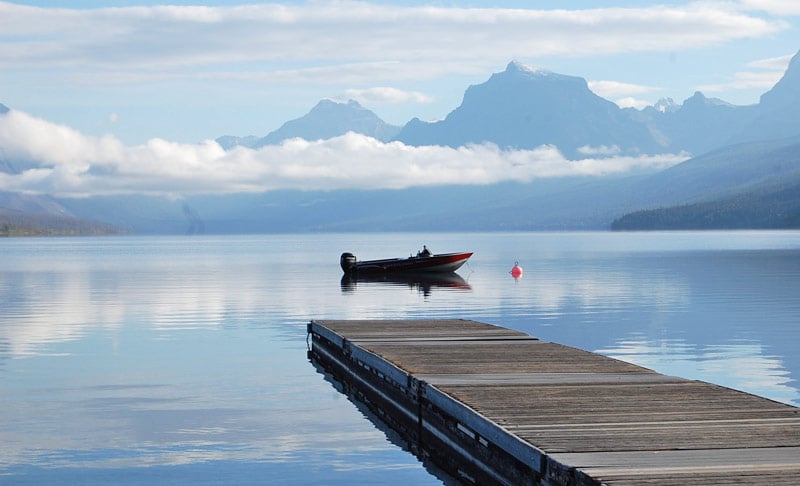
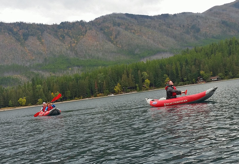
Just beyond the Apgar Visitor Center will be your first sighting of Lake McDonald, a 10-mile-long body of water that bumps up against Going-to-the-Sun Road for several miles.
Here you’ll find a campground, a lodge, and a parking lot where you can pull in and glimpse some extraordinary views.
Make arrangements with companies like Great Northern to rent kayaks or paddleboards and get out on the lake, where the sights are even more spectacular.
Mile 11: Lake McDonald Lodge
Operated by the NPS, Lake McDonald Lodge is a Swiss chalet-style property. Constructed in 1913, the historic lodge has more than 80 guest rooms, a couple of restaurants, and a gift shop.
Even if you don’t plan on spending the night, it’s worth stopping to see the outdoorsy vibe of the interior, which has moose and deer mounts and a mountain goat fur rug hanging from the balconies.
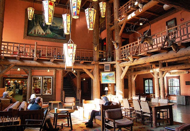
Head out back behind the lodge for another perspective of the lake, or to sign up for a scenic lake cruise.

Mile 12: McDonald Falls
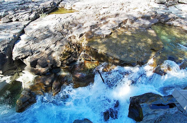
Past Lake McDonald, there’s a small pullout at McDonald Falls. It’s amazing to see how tame and mild the water flow is upstream, and then when it hits the large group of rocks, it suddenly gains speed and force in a hurry.
This is not a huge waterfall, but its power is impressive.
Mile 16: Avalanche Creek and Trail of the Cedars

Where Avalanche Creek meets Going-to-the-Sun Road, you’ll find the Trail of the Cedars, a short (half-mile) wheelchair-accessible path through the forest.
Trail of the Cedars is not a challenging hike at all; in fact, it’s really just a scenic walk past some of Glacier’s most impressive trees, including Western Red Cedar, Black Cottonwood, and Western Hemlock.

Glacier NP is the farthest east in the U.S. you can see these cedars and hemlocks, which typically flourish in the rainforests of the Pacific Northwest. Some of the trees here are 500 years old and more than 7 feet in diameter.

Note: If your vehicle is over 21 feet long or 8 feet wide, you’ll have to stop here and turn around, because large vehicles are not permitted on the narrow alpine section of the road that follows.
Mile 23: West Side Tunnel
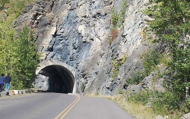
Going-to-the-Sun Highway features two tunnels. The shorter one, at 192 feet long, appears on a narrow, uphill section of the road.
This tunnel has holes, or “windows,” in the side, allowing people to look out at the Upper McDonald Creek Valley.
There’s a sidewalk inside too, so you can park on a pullout beyond the tunnel and walk back to see the views.
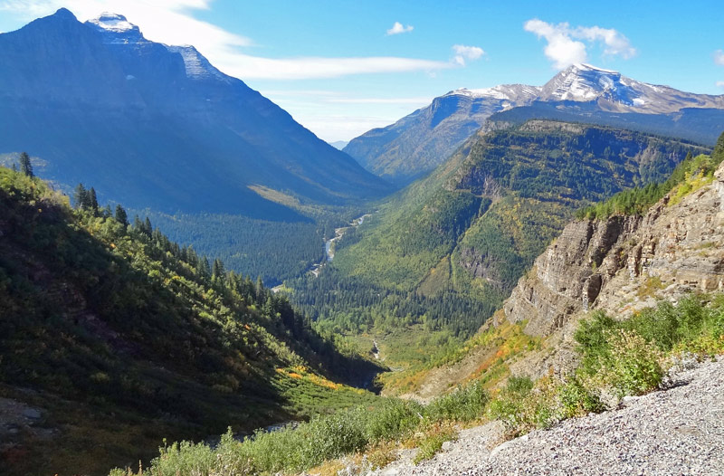
Mile 24: Heavens Peak & The Loop Switchback

On the map of Going-to-the-Sun Road, you’ll notice that at one point, the road makes a hairpin turn and continues almost 180 degrees in the other direction.
This “Loop” switchback is one of the main reasons why large RVs and campers are not allowed on the road.
You’ll find a small parking lot at the Loop, since it’s a must-stop destination. On one side stands Heavens Peak, an 8987-foot peak often covered with snow.
In the other direction is the start of Loop Trail, a popular hike that connects with Granite Park Chalet and the Highline Trail.

The Loop Trail area has a lot of dead trees from a 2003 fire. The empty space makes for more open, panoramic views of the Loop and its surrounding peaks.
Mile 27: Bird Woman Falls
Around Mile 27, you’ll find a couple of small pullouts on the road that offer views of Mount Oberlin, Clements Mountain, and Cannon Mountain.
In the middle of these peaks sits a remnant glacier, which in the spring and early summer feeds into a 500-foot waterfall known as Bird Woman Falls.
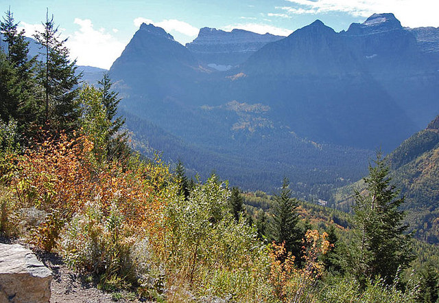
You can’t see the waterfall in this distant pic, which was taken in early autumn, when the falls sometimes dry up, but this is the set of peaks you’re looking for. Wikimedia has a clearer shot of the waterfall coming out of the middle of the mountain.
Mile 28: Haystack Falls

Haystack Falls is a waterfall that pours down next to the road. A small arch was built to go over the falls, allowing the water to pass underneath the road.
This is another one of those sights that makes you understand why Going-to-the-Sun Road was such an engineering feat.
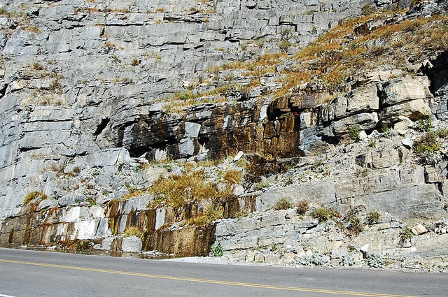
Mile 29: Weeping Wall
Weeping Wall was named after the melting snow runoff that pours out through the rocks onto Going-to-the-Sun Road.
In the spring, water can gush at Weeping Wall and drench the road (and your vehicle) with cold mountain water. Later in the summer, the runoff becomes more like a trickle.
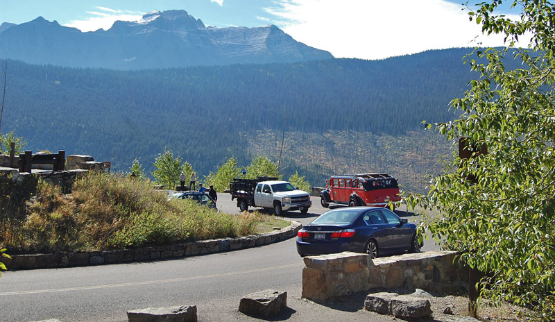
Mile 30: Big Bend
The “Big Bend” is a turnout offering more great mountain views. It’s one of the best places between the Loop and Logan Pass to park, catch your breath for a minute, and catch some spectacular scenery.
Mile 30: Triple Arches
Just past the Big Bend is a 60-foot section of the road where the mountain was so steep that there was no flat ground on which to put a road. So, workers built build a stone bridge with three arches to cross this tricky mountain gap.
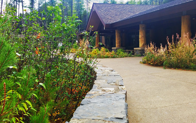
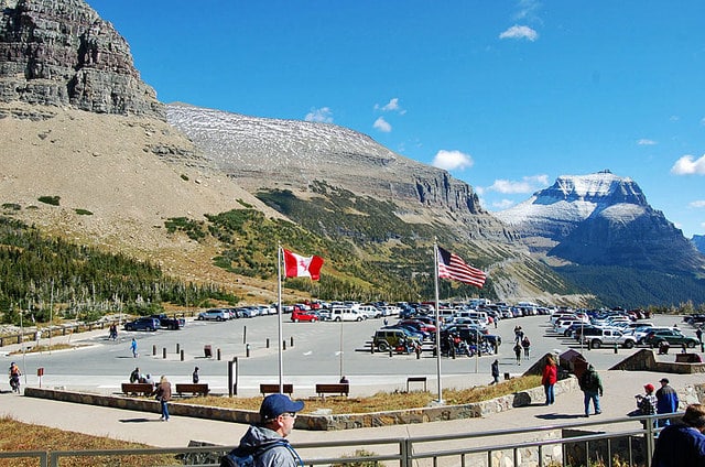
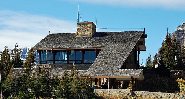
Mile 32: Logan Pass Visitor Center
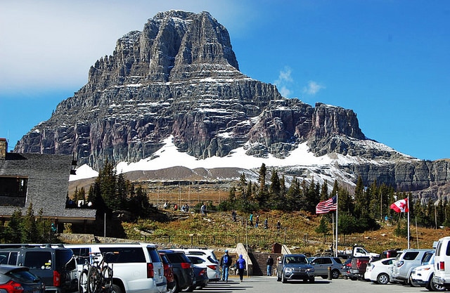
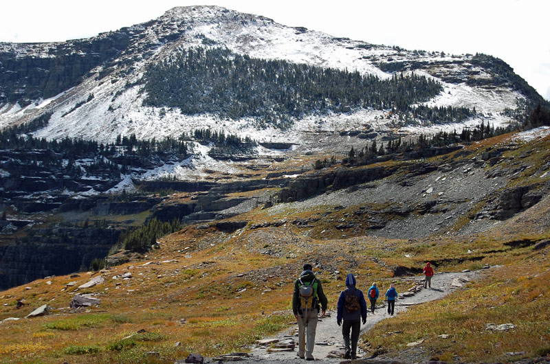
You’ve finally made it! Situated along the Continental Divide, Logan Pass is one of Glacier’s most famous spots. At 6646 feet, it’s the highest point on Going-to-the-Sun Road, and the 360° views here are incredible.
Logan Pass is a great spot to go hiking. You can jump on the trail to Hidden Lake (a great place to see mountain goats) or the Highline Trail.
Check out these poles on the top of the visitor center. They help park officials find the building in the spring, because it can be totally buried in snow.
The center often does not open until July due to the snow buildup. Stop in for souvenirs, advice from rangers, and a potty break.
During peak season (July/August), the parking lot at Logan Pass sometimes fills to capacity, so you may have to circle around waiting for a space or simply move on.
To avoid that unfortunate outcome, arrive here early in the morning (by 9 am at the absolute latest!) to beat the rush.
Mile 33: Big Drift
This is the spot along the road where up to 80 feet of snow can settle during the windy winters. Because the snow gets so deep, removal is an arduous and time-consuming process involving special equipment.
It can take a few weeks just to clear this mile-long stretch of the road. Even after the road is made ready for vehicles in June or July, you may see several feet of snow here on the side of the road long after it’s open to vehicles.
Check out this amazing video of the snow removal process at Glacier National Park:
Mile 34: East Side Tunnel
The East Side Tunnel is considered one of the greatest engineering feats on Going-to-the-Sun Road.
Back in 1932 when the 408-foot structure was built, no power equipment could reach this part of the park, so workers had to carry out by hand all the rock they blasted away. Imagine how tedious that must have been!
Mile 35: Siyeh Bend
Like Big Bend on the west side of the road, Siyeh Bend is a spot where the road loops around, leading to great scenery of the surrounding mountains.
The parking lot here allows visitors to get out and jump on the Siyeh Pass Loop, a strenuous 10-mile hike that runs past alpine meadows and wildflowers.
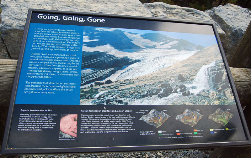
Mile 37: Jackson Glacier
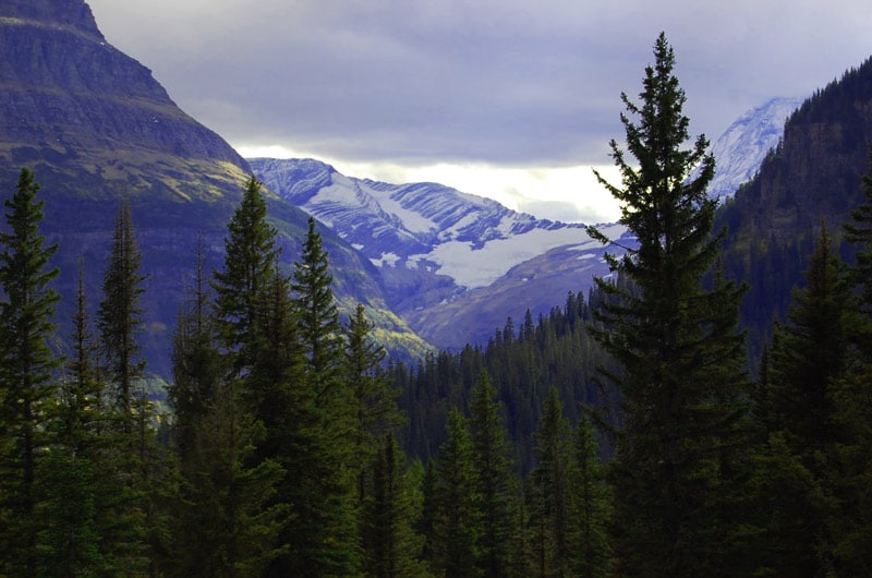
Many of Glacier National Park’s glaciers aren’t visible from the road, but Jackson Glacier is very easy to see at this overlook. There it is in the distance on Mount Jackson, the fourth-highest peak in Glacier NP at 10,052 feet.
The overlook has NPS informational signs describing how the park’s glaciers are rapidly disappearing due to climate change.
By current estimates, all of the glaciers here could be gone as soon as the year 2030. The news is sobering, but it’s good information for everyone to have.
There aren’t a ton of chances to actually see glaciers in Glacier National Park, so take advantage of this opportunity!
Mile 40: Sunrift Gorge and Waterfalls
Just off Going-to-the-Sun Road is Sunrift Gorge, a narrow break in the rock formation that allows water to rush through. It’s like a waterfall, but cooler.
Speaking of waterfalls, Baring Falls, Virginia Falls, and Saint Mary Falls can all be reached via short hike from this stop.
Mile 41: Sun Point Nature Trail
The Sun Point Nature Trail is a 1.4-mile out and back walking path. The trail takes visitors along Saint Mary Lake leads them past the same waterfalls that are accessible at the Sunrift Gorge stop. Expect heavy winds and beautiful views!
Miles 40-44: Evidence of Wildfire
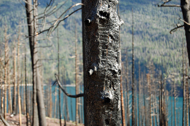
Folks driving Going to the Sun Road between Sunrift Gorge and Rising Sun will notice the evidence from the Reynolds Creek Fire that tore through thousands of acres of Glacier NP in the summer of 2015, closing down sections of the park for weeks.
Dead trees and brush litter the landscape. Stop at any of the small pullouts in this area to witness the aftermath up close. Now that it’s been a few years, much of the vegetation in this area has regrown.
Fires are a natural part of any ecosystem because they facilitate long-term health of an area by replenishing the soil and essentially recycling nutrients into the ground. That’s why national park officials often let fires burn themselves out.
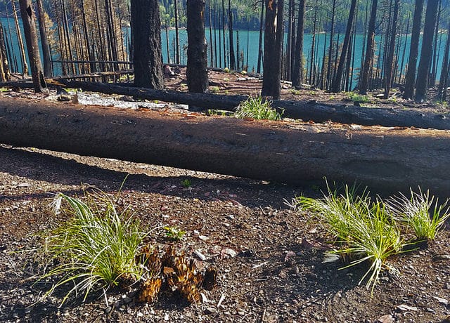
The effects of fires can be seen for years after, but even as you observe all the charred trees, you’ll also notice new green shrubs and grasses on the ground.
They began popping up just a few short weeks after the fire went out. Isn’t it amazing how nature revitalizes itself?
Mile 43: Wild Goose Island
One of the iconic images of Glacier NP is tiny Wild Goose Island, situated in the middle of Saint Mary Lake surrounded by water and mountains.
How this piece of land survived the rampage of glaciers that came through thousands of years ago remains a mystery, but it now stands proudly on its own.
You can see why this is such a popular photography spot. The mountain peaks rise close to 4000 feet above the lake. Good news: There’s a full-size parking lot here rather than just a pullout.

Mile 44: Rising Sun
Located at an elevation of 4800 feet, the Rising Sun campground has 84 camp sites. Also in this area, you can find a camp store, a lodge, picnic sites, and a boat dock providing access to Saint Mary Lake.
Mile 51: Saint Mary Visitor Center
Here’s your last stop on the road (if you’re coming from the east, it will be your first.) The Saint Mary Visitor Center once offered a webcam with views of Red Eagle Mountain and the nearby meadows, but as of 2018 that has been taken offline.
This is a great place to decide where you’d like to go next. Perhaps take Route 89 up towards the popular Many Glacier area? Or head down to Route 2 and take the southern route back to West Glacier?
Mile 52: Town of Saint Mary
Congrats on completing your journey! Going-to-the-Sun Road ends in Saint Mary, so it’s time to grab dinner at a restaurant or check in to the St. Mary Lodge and soak in the colorful sunset.

This Glacier National Park scenic drive experience can be very different coming from each direction, so why not wake early tomorrow and drive Going-to-the-Sun Road going the other way?
Is Going to the Sun Road Scary?
No, not at all! Some people have heard that driving Going-to-the-Sun Road can be scary, but that’s not really the case.
There are just a couple of sharp turns you’ll have to navigate near Logan Pass, but otherwise it’s a pretty relaxing drive with gorgeous scenery.
The biggest hairpin turn near Logan Pass is pretty cool, actually, as it’s essentially a switchback for vehicles, which you don’t see very often.
That’s really the only spot on the entire road that has any “danger,” so to speak, because the mountain does drop off steeply from the road there. But there’s a big rock wall to serve as a buffer. It’s not a problem for folks driving the road and should not be scary at all.
Where to Stay in Glacier National Park
Going to the Sun Road has a few hotels, campgrounds, and lodges, so you’ll plenty of lodging options at different price points. Due to limited availability and high demand, most of these require booking months in advance – even the campgrounds!
See the official NPS page for information on campgrounds. I’ve stayed at Many Glacier Campground and highly recommend it because it’s in one of the most scenic parts of the park.
As for lodges within the park boundaries, you have several options. I can offer personal reviews on several places to stay in Glacier National Park.
Glacier Outdoor Center is located right near the west entrance of the park. Here, the wooden chalets felt quiet, secluded and comfortable. It’s here that I went fly fishing for the first time.

Nearby is Belton Chalet, which offers quaint but clean rooms and a very fancy restaurant.
On the east side of the park, Many Glacier Hotel is the largest hotel in the park. It’s situated in a gorgeous location right on Swiftcurrent Lake, where you can kayak or hike. It was built in 1915 and has an old-time winter lodge kind of feel.
On the southern end of the park, Izaak Walton Inn has cozy and nice rooms. This hotel is not on Going to the Sun Road, but if you travel Route 2, you may want to spend a night here. It’s also right on the train, so Amtrak riders from Chicago to Seattle can conveniently stop here.
If you venture beyond the park boundaries to the fun town of Whitefish, I highly recommend Whitefish Downtown Suites. The rooms are on the second level just above the busy downtown streets below.
And finally, if hostels are more your thing, good options include the Whitefish Hostel and North Fork Hostel, which is located near Polebridge, the town without electricity.
SEE MORE MONTANA ARTICLES
Huckleberry Madness in Montana – The Food of Glacier Country
Boiled Buffalo Tongue and Backcountry Off-Roading on the Blackfeet Reservation
First impressions of Glacier National Park at Bowman Lake
Bonus: Can You Drive Going-to-the-Sun Road in Winter?
As noted, dozens of feet of snow fall at the highest elevations of Going-to-the-Sun during the winter. So most of the road closes from roughly October through May.
However, a portion of Going to the Sun Road does remain open during winter. That’s the western entrance at West Glacier. The westernmost 11 miles of Going to the Sun Road, up through Lake McDonald, are plowed and therefore stay open to vehicles all year.
Apgar Visitor Center is also open, and they even offer snowshoe walks on two weekends each winter (usually January and March.) Snowshoes can be rented for $2.
Most people who want to see Glacier National Park come during the summer. But if you find yourself in western Montana during the snowy months – perhaps to go skiing in Whitefish? – then it’s worth making the drive over to see Glacier in its winter wonderland state.
Remember that during winter, spring, summer, or fall, you can also check the status of GTTS Road and the other major roads on the park’s road status page.
You can arrive to Glacier NP via Amtrak, which has stations in West Glacier and East Glacier Park. And Going-to-the-Sun Road is a great stop if you’re doing a long road trip, like the Chicago to Seattle drive or the Chicago to Banff drive.
What’s your favorite part of Going to the Sun Road?